


Hurricanes Jose and Maria are expected to hit the East Coast in the next ten days. They could wreak havoc on the already-stretched national logistics infrastructure.
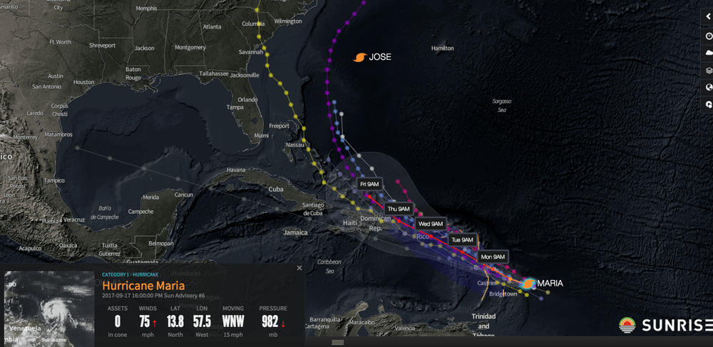
Image courtesy of Riskpulse- Hurricane JoseThis has certainly be an eventful hurricane season. First it was Texas, then Florida, and now mother nature is prepared to take out the Eastern Seaboard with a double play involving two storms, Jose and Maria. According to the weather experts at Riskpluse, we should be on alert over the next ten days for tropical activity along the Eastern coast of the US.
Riskpulse’s Sunday weather supply-chain weather update stated:
“Both Jose and Maria will have some influence on the East Coast this week and into next. Jose is the first threat and will be moving north paralleling the Coast during the next 5 days. After that, numerous models indicate the projected steering currents will force Jose to do a loop and potentially come back toward the East Coast as the storm moves due west for a period of time. Thus, there are 2 opportunities for Jose to make landfall – the first late this week (late Wednesday/Thursday) most likely on eastern Long Island or Cape Cod with a second possible landfall next Sunday/Monday most likely in, or around, the New Jersey area.
Both storms will have some impact on the East Coast – the question is extent and magnitude. It is debatable whether either storm make landfall on the East Coast but it is possible for both and in the very least, both will be relatively close to the Coast. A direct landfall, of course, would have a much more substantial impact than a storm that stays just off the Coast.
We are putting the odds of Jose making landfall on the East Coast at 50/50. As stated above, there are 2 possible time-frames of landfall – late this week (the first “run” at the Coast) and early next week (after the storm loops and starts coming back west toward the Coast).
As for Maria, we also put odds at 50/50 of the storm making landfall on the East Coast early next week.
While we see little threat of any activity in the Gulf of Mexico during the next 10 days, the chance is not 0. We put the odds of a named storm in the Gulf of Mexico during the next 10 days at 5 percent; this small chance is a function of Maria.”
Jose is no where as strong as Harvey or Irma, clocking in only at 90MPH, but the density of population centers along the East Coast where it could potentially hit are concerning. Sandy was not a hurricane when it hit NY and still considered one of the most expensive storms in US history.
Maria is gaining strength and could be a category three by the time it hits landfall.
The greater concern for folks in the US logistics industry is the exaustion of the market capacity should another hurricane make landfall. Trucks are already in short-supply and its reverberating in trucking spot-rates. Plus, with each storm being nearly a thousand mile apart from the previous one, it will stretch the supply-chains of companies as they scramble to respond. While most people assume that trucking capacity impacts are local, that is not true. Any surge in demand in one market has a secondary impact in another market, as carriers shift capacity to take advantage of higher rates and demand. Additionally, one shouldn’t forget that September is the end of the third quarter and the start of the super-heavy fourth quarter shipping season.
Subscribe to FreightWaves for more updates from Riskpulse, DAT, Breakthrough Fuel, and other sources as we provide updates and commentary on market impacts.