


Spring is in full swing, and this may become even more evident across the Great Plains this week. Severe thunderstorms are likely to rumble across portions of several states through at least Wednesday, with all types of seasonal severe weather possible. A lot of people in the nation’s heartland will need to keep their eyes and ears to the sky and remain “weather aware.”
Set Up
A frontal boundary will remain nearly stationary from Texas all the way to the Midwest for the next several days. Storms typically develop along and near a front because of sharp differences in temperature and humidity across the boundary. Also, waves of low pressure will travel along the front, adding energy to the atmosphere and increasing the odds for storms. With other dynamic factors in place, like wind shear – winds becoming faster with height and changing direction with height – the sky could open up at a moment’s notice, and storms could turn strong or severe.
Target Areas
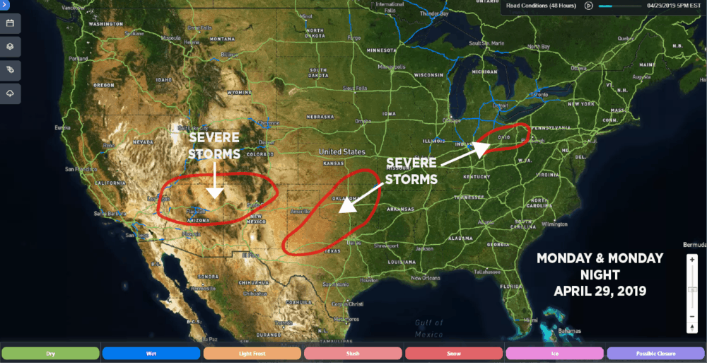
Rest of today (Monday, April 29, 2019): Parts of the Four Corners region; portions of western and northern Texas, mostly east of I-27 and north of I-40; Oklahoma City metro area; portions of Ohio.
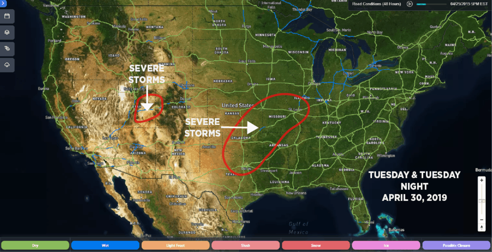
Tuesday (April 30, 2019): Portions of eastern Utah and western Colorado; Dallas and Oklahoma City metro areas through southeastern Kansas, northwestern Arkansas, St. Louis and western Illinois.
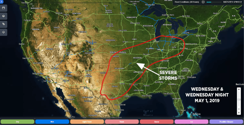
Wednesday (May 1, 2019): Same areas as Tuesday, in addition to the rest of Illinois, Indiana, Ohio, northern Kentucky and western Pennsylvania.
As of this afternoon, it looks like the severe risk will be highest on Tuesday, but storms could cause delays in freight movement all three days. Drivers will be slowed down on portions of major interstate highways such as I-20, I-35, I-40 and I-70 across the Great Plains.
What to Expect
Strong wind shear will help add rotation to the atmosphere, and freezing levels will be fairly low in the towering storm clouds. So, some storms may produce damaging supercell thunderstorms with powerful winds and large hail each day, not to mention tornadoes. Also, the severe storms could develop day or night and will likely be scattered rather than extremely widespread.
The National Weather Service defines a severe thunderstorm as one that produces any or all of the following, as indicated on radar or observed by someone in the field:
• Winds of at least 58 mph
• Hail at least one inch in diameter
• A tornado
Keep in mind that even storms that don’t reach severe limits can cause damage. They can also dump torrential rains – possibly in some of the same places over and over again, a process called “training” – leading to several episodes of flash flooding. So, there’s the potential for roadblocks, especially on secondary routes.
Stay In The Loop
The best way to lower the odds of being caught off guard while on the road is to tune in to as many information sources as possible. Weather can change quickly, so get the latest official NWS weather alerts here, and look for weather updates on the Freight Waves website. Also, sign up for weather alerts on your mobile devices, and watch local meteorologists on television when taking breaks.
