


The Midwest has been getting a break recently from the record-breaking, prolonged cold snap in late January. Temperatures plummeted to 40 degrees below zero or lower from the Dakotas to the Great Lakes, with wind chills in the 50s and 60s below zero. Roads, homes, lakes and rivers froze over, but much of the region has thawed out since last Friday. However, a large swath of icy weather is coming back very soon, targeting two major metropolitan areas.
The first of two winter storms this week will arrive early this evening (Tuesday, January 5). Precipitation may start as a messy mix of rain, sleet, and freezing rain across northern Illinois and southern Wisconsin, but freezing rain will develop in more and more neighborhoods between rush hour and midnight, including the Chicago area. This will create dangerous, icy conditions for drivers on many delivery routes.
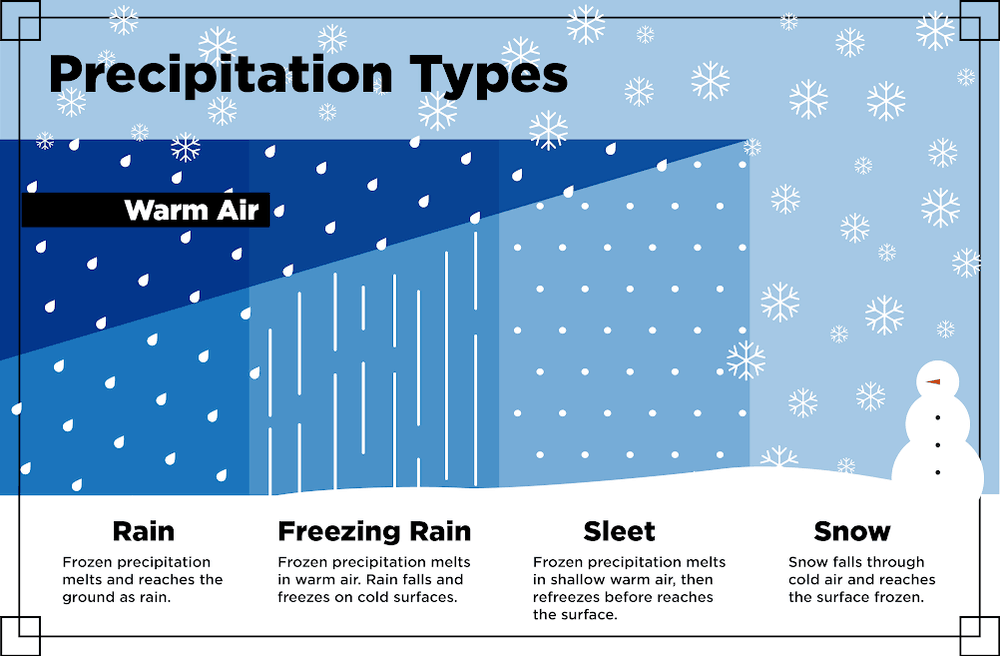
But what is freezing rain, you may ask? Well, sometimes the air just above the ground can be warmer than the ground itself, although it’s usually the opposite. This is called a temperature inversion. Freezing rain falls as liquid through a layer of warm air aloft, then freezes onto the ground and other surfaces that are at/or below freezing. The result is ice build-up which can weigh down trees and power lines, as well as making travel impossible in some cases. How bad this storm becomes depends a lot on surface temperatures.
Significant ice accumulations as thick as four-tenths of an inch are possible north of downtown Chicago, and one-quarter to one-third of an inch in the city. Accumulation of around a quarter-inch is also likely from eastern Iowa (Davenport) to central Missouri (Columbia). Night shift drivers may want to avoid these areas like the plague. The worst conditions will be on secondary routes and any untreated surfaces. But portions of major routes like I-55, I-80 and I-90 may also get iced over for several hours, making travel risky or simply hopeless. Some roads may have be closed.
Later in the night, especially after 2:00 a.m., the threat for freezing rain and ice fades across Chicago and shifts to the Detroit metro area. Not as much ice is expected in The Motor City – up to two-tenths of an inch – but it could be just enough to cause problems from late tonight until a couple of hours after sunrise Wednesday. Then, the risk for ice moves into the Northeast Wednesday afternoon through Thursday.

The National Weather Service (NWS) has issued Ice Storm Warnings for many counties and may add more. They can be found on this very handy interactive map.
The second storm will bring heavy snow to parts of the Midwest on Thursday and Thursday night, along with strong winds and blizzard conditions. Look for details on this storm on Wednesday on the FreightWaves website.
