


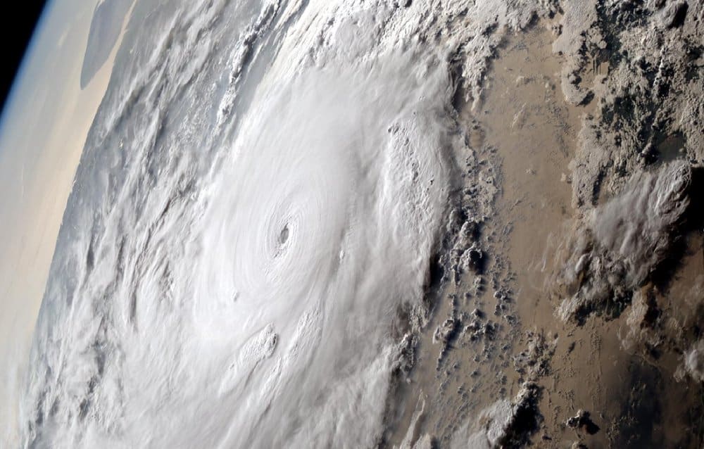
Super Cyclonic Storm Fani is closing in on the eastern coast of India. Fani’s ferocious winds measured 155 mph as of 8:00 p.m. local time today, May 2, 2019 (India is 9.5 hours ahead of U.S. Eastern Daylight Time). According to the India Meteorological Department (IMD), Fani is likely to make landfall at the Odisha coast, between Gopalpur and Chandbali, as early as sunrise on Friday, May 3. Winds at landfall could still be as strong as a Category three hurricane (111-129 mph).
Nineteen districts in the states of Andhra Pradesh, Odisha and West Bengal are likely to be hit by the powerful cyclone. The IMD has issued a “Yellow Alert” warning for Odisha, West Bengal and three districts of Andhra Pradesh. Also, in a special bulletin issued on Wednesday, the IMD forewarned about possible destruction, and fishermen were warned not to venture out for fishing from May 1 to May 5.
New Delhi Television Limited (NDTV) reported earlier today that almost one million people have been evacuated to temporary shelters in Odisha. Fani could become almost as destructive as the super cyclone of 1999, which killed almost 10,000 people and left a trail of destruction across Odisha. The IMD said it’s the first cyclonic storm of such severity in April in India’s oceanic neighborhood in 43 years. Fani is expected to make landfall on the morning of May 3 morning very close to Puri, home to the famous Jagannath temple. Around 10,000 villages and more than 50 towns lie on its path.
Fani’s increasing threat to safety has already led to disruptions in transportation. The East Coast Railway has cancelled more than 200 more trains, and the Directorate General of Civil Aviation has temporary cancelled all flights at Kolkata and Bhubaneswar Airports.
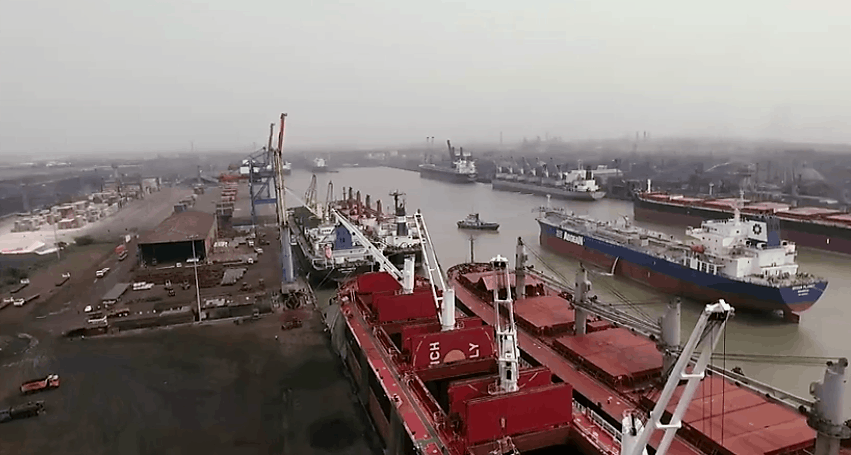
After Fani makes landfall, the storm is expected to turn a bit to the northeast toward the city of Haldia, which has a population of around 208,000 people and is home to a major port in the state of West Bengal. Located about 30 miles southwest of Kolkata (formerly Calcutta), the Port of Haldia lies near the mouth of the Hugli River, one of the distributaries of the Ganges River. The dock is located on the banks of the Hugli River off the Bay of Bengal. The port is currently being developed as a trade port for bulk cargoes serving Kolkata.
The Port of Haldia contains many factories, including several owned by companies like Mitsubishi Chemicals, as well as several light industries. It is also a base for India’s Coast Guard, with a hover-port housing two of the Coast Guard’s six hovercrafts. The Port of Haldia is the fourth-largest port in India, and it is part of the Port of Kolkata. In 2006, the Port of Haldia handled a record 43 million tons of cargo. The port can handle large vessels and has a fully equipped container-handling facility.
By the time Fani gets close to the Port of Haldia on the evening of May 3, its winds are forecast to be around 65 mph. However, this outlook could change for the better or worse. The wind, combined with possible heavy rainfall and storm surge, could do a fair amount of damage. At minimum, it may delay ships from entering or leaving the dock. Indian Oil Corporation, Ltd (National Stock Exchange of India: IOC) is also located in Haldia. Depending on the amount of damage to the refinery and surrounding communities, production could slow down for a while.
