


The Sierra Nevada Range, located between the Great Basin and California’s Central Valley (from Bakersfield and Sacramento up to Redding), has been getting its share of snowfall this season. This isn’t unusual, considering the Sierras includes Mount Whitney (14,505 feet above sea level), the tallest mountain in the lower 48 states. But, snowpack so far is higher than normal, and another storm is fast approaching.
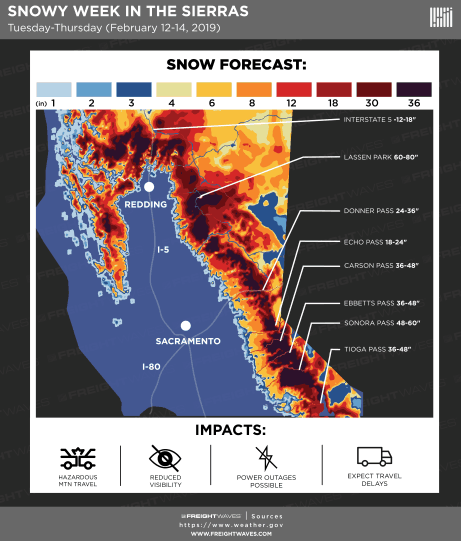
A low pressure system off the West Coast will send abundant moisture across California the next few days, producing plenty of snow in the Sierras, in addition to heavy rain in the foothills and parts of the San Francisco Bay area. The result won’t be unusually high amounts of snow for a single storm, but it will add to a snowpack that, according to the National Weather Service (NWS), is more than eight feet deep in some areas, having increased nearly three feet in the past week. Here are three notable differences in the region’s snowpack compared to this time last year:
FEB 11, 2019 FEB 11, 2018
Area Covered By Snow 83.0% 25.5%
Average Depth 39.2” 3.0”
Average Water Equivalent 10.5” 0.9”
Brendon Rudin-Oster, a meteorologist at the NWS office in Sacramento, told FreightWaves that the central Sierras, which include the Greater Lake Tahoe area (Lake Tahoe, Nevada plus South Lake Tahoe and Truckee in California), stand at 135 percent of normal snowpack for this time of year. He said it’s often “feast or famine” when it comes to winter storms, but this season has been keeping him and his colleagues pretty busy. Rain and snow have wiped away a minor drought that lingered in parts of the region for months.
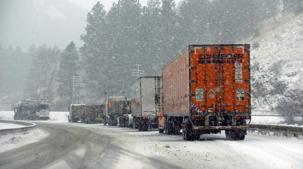
Light snow will begin today (Tuesday), falling harder from tonight through Wednesday, with lingering snow showers on Thursday. After it’s all said and done, several more feet will accumulate across much of the higher elevations.
According to Rudin-Oster, this storm will be different than the past few because he expects cold air to shut off in the foothills. Elevations as low as 2,000 feet could see snow today, but as warm air enters the storm at low levels on Wednesday, the snow will change to rain in the lower slopes and foothills. The rain could get heavy enough to cause flooding from Redding southward to Yosemite National Park and Bakersfield. Strong winds could cause blowing snow and low visibility at times in the high elevations, while flooding could lead to mudslides and debris flows down below. Look for winter weather alerts and flood alerts from the National Weather Service on this interactive map.

Unfortunately, the storm is coming during the busiest time of the week for truckers. The FreightWaves SONAR Hours of Service index (HOS11.USA) consistently shows Tuesday, Wednesday and Thursday as the days with the most drivers on the roads, but many of them may get delayed or turned around. Rudin-Oster said sections of I-80 through the Sierras were closed for more than 24 hours during last weekend’s storm. Carriers should plan accordingly, perhaps waiting to send loads or using alternate routes, if possible. Drivers can stay updated on the latest chain laws here. Please stay safe out there!