




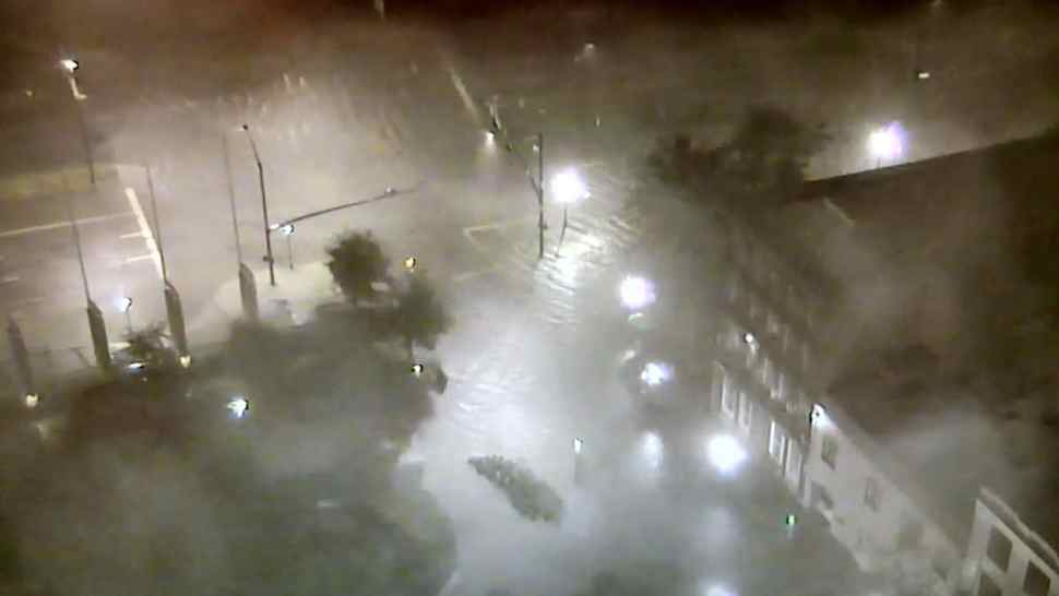
Hurricane Nate came ashore late Saturday night and by this morning had been downgraded to tropical storm with winds of 45 mph gusting to 55 mph at times as it moves toward the north-northeast at more than 25 mph.
The storm made landfall in Louisiana Saturday night and a second landfall as a Category 1 hurricane in Biloxi, Mississippi. Heavy rainfall should continue along the southeast today before the remnants quickly move out of the area, bringing rain and gusty winds to the Northeast on Monday, the Weather Channel said.
A flash flood watch is in effect for Birmingham, AL, where rainfall of 2 to 4 inches additional today with locally higher amounts is possible.
“Nate will bring heavy rainfall of 3 to 6 inches with isolated totals of 10 inches east of the Mississippi River from the central Gulf Coast into the Deep South, eastern Tennessee Valley, and southern Appalachians through Monday, resulting in the potential for flash flooding in these areas,” the National Hurricane Center said. “Moisture from Nate interacting with a frontal zone will also bring 2 to 5 inches of rain with isolated totals of 7 inches across the Ohio Valley and central Appalachians Sunday and Monday, which will increase the risk for flash flooding across these locations.”
Weather.com notes that the quick forward speed of Nate will bring strong winds capable of downing trees and causing structural damage far inland, including to areas such as Birmingham, Huntsville, Atlanta, Chattanooga and Knoxville Sunday and Sunday night.
According to supply chain risk analysis firm Riskpulse, areas of Tennessee as well as Alabama and Mississippi remain trouble spots for any carrier or shipper with assets in the region.
It appears that much of the southeast may have dodge major damage that Florida and Texas suffered from more powerful Hurricanes Irma and Harvey. In Mobile County in Alabama, officials told AL.com that there had been only light damage to roads and only a couple of roads were impassable.
There were reports of some areas of Alabama and Mississippi flooding, including a major road in Mobile, but no indications that the flooding was widespread. At least 100,000 people in the region were without power, officials said.
In Jackson County, MS, officials with the Office of Emergency Services said there had been no reports of major damage in the county and let expire a curfew that that had been in effect for residents.
Brokerage Compliance Symposium
The day before F3. Every compliance issue you face - fraud exposure, carrier liability, FMCSA rules, cargo theft, insurance gaps - navigated by attorneys and operators defining best practices in a changing industry.
F3 Awards Dinner
The night before F3. FreightTech100 companies honored. FreightTech 25 and Shipper of Choice winners revealed live. Cocktail reception into dinner and live music - 300 industry leaders in one purpose-built room.
F3: Future of Freight Festival
Industry-defining keynotes, rapid-fire technology demos, and industry leaders networking in experiences across Chattanooga - plus the inaugural F3 Awards Dinner featuring the FreightTech and Shipper of Choice reveals.
The day before F3. Every compliance issue you face - fraud exposure, carrier liability, FMCSA rules, cargo theft, insurance gaps - navigated by attorneys and operators defining best practices in a changing industry.
The Signal at Chattanooga Choo Choo • Chattanooga, TN Register NowThe night before F3. FreightTech100 companies honored. FreightTech 25 and Shipper of Choice winners revealed live. Cocktail reception into dinner and live music - 300 industry leaders in one purpose-built room.
The Signal at Chattanooga Choo Choo • Chattanooga, TN Register NowIndustry-defining keynotes, rapid-fire technology demos, and industry leaders networking in experiences across Chattanooga - plus the inaugural F3 Awards Dinner featuring the FreightTech and Shipper of Choice reveals.
The Signal at Chattanooga Choo Choo • Chattanooga, TN Register Now