




Troubles ongoing in Houston, Beaumont
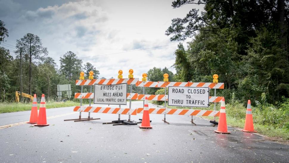
Tropical Storm Imelda did a lot of damage to southeastern Texas last week, mostly in the form of major flooding. Shippers and carriers should expect at least minor delays to continue in this region as drivers will have to use secondary routes to get around problem areas.
The I-10 bridge remains closed over the San Jacinto River, just east of Houston. Barges came loose in the rushing waters and slammed into the bridge on Sept. 20. According to the Texas Department of Transportation, the rest of I-10, as well as most secondary roads are in good shape in the Houston area.

However, many secondary roads are still closed in the Beaumont and Port Arthur, Texas, areas, as well as in southwestern Louisiana. The National Weather Service (NWS) is forecasting moderate to major flooding to continue into tomorrow, Sept. 24, in these areas and others along the Neches, Calcasieu and Sabine rivers. This could cut off access to interstate ramps and/or additional secondary roads. Flood warnings issued by the NWS over the weekend remain in effect until further notice.
Other U.S. weather today

Periods of showers and thunderstorms will continue to soak many portions of the drought-stricken Desert Southwest today and tonight, thanks in part to the remnants of Tropical Storm Lorena (which was a Pacific storm). This will affect areas from southeastern California through Arizona and western New Mexico, including the Phoenix and Tucson metropolitan areas along the I-10 corridor. The NWS has issued a flash flood watch for the region. Based on radar-indicated rainfall rates, flash flooding has likely occurred this morning just south of downtown Phoenix.
Deep tropical moisture from the remnants of Lorena will continue to interact with a strong and developing Pacific low-pressure system approaching the southwestern U.S. The result will be more very heavy rainfall across much of the region this afternoon, Sept. 23, into tomorrow. Peak rainfall rates will be well above one inch per hour at times. Water levels may rise rapidly, flowing into area homes and businesses. Flash flooding will likely result in road closures, with rockslides and mudslides possible. Some thunderstorms may reach severe limits across the Desert Southwest, producing large hail and powerful wind gusts.
A few severe storms could also pop up across interior portions of the Northeast as a cold front moves through the region this afternoon and tonight.
Tropicals watch

Tropical Storm Karen will likely arrive in Puerto Rico, as well as the U.S. and British Virgin Islands, Sept. 24, bringing the potential for flooding, wind damage and mudslides. Winds are currently at 40 mph but could get a little stronger before landfall. The National Hurricane Center (NHC) has issued a Tropical Storm Warning and a Hurricane Watch for the previously mentioned areas. It’s still too early to pinpoint Karen’s track and strength for later in the week. However, there’s a chance it could strike the Bahamas by Sept. 29, then southern Florida by Sept. 30. Look for updates throughout the week on the FreightWaves website and social media accounts.
Have a great day, and be careful out there!
Brokerage Compliance Symposium
The day before F3. Every compliance issue you face - fraud exposure, carrier liability, FMCSA rules, cargo theft, insurance gaps - navigated by attorneys and operators defining best practices in a changing industry.
F3 Awards Dinner
The night before F3. FreightTech100 companies honored. FreightTech 25 and Shipper of Choice winners revealed live. Cocktail reception into dinner and live music - 300 industry leaders in one purpose-built room.
F3: Future of Freight Festival
Industry-defining keynotes, rapid-fire technology demos, and industry leaders networking in experiences across Chattanooga - plus the inaugural F3 Awards Dinner featuring the FreightTech and Shipper of Choice reveals.
The day before F3. Every compliance issue you face - fraud exposure, carrier liability, FMCSA rules, cargo theft, insurance gaps - navigated by attorneys and operators defining best practices in a changing industry.
The Signal at Chattanooga Choo Choo • Chattanooga, TN Register NowThe night before F3. FreightTech100 companies honored. FreightTech 25 and Shipper of Choice winners revealed live. Cocktail reception into dinner and live music - 300 industry leaders in one purpose-built room.
The Signal at Chattanooga Choo Choo • Chattanooga, TN Register NowIndustry-defining keynotes, rapid-fire technology demos, and industry leaders networking in experiences across Chattanooga - plus the inaugural F3 Awards Dinner featuring the FreightTech and Shipper of Choice reveals.
The Signal at Chattanooga Choo Choo • Chattanooga, TN Register Now