




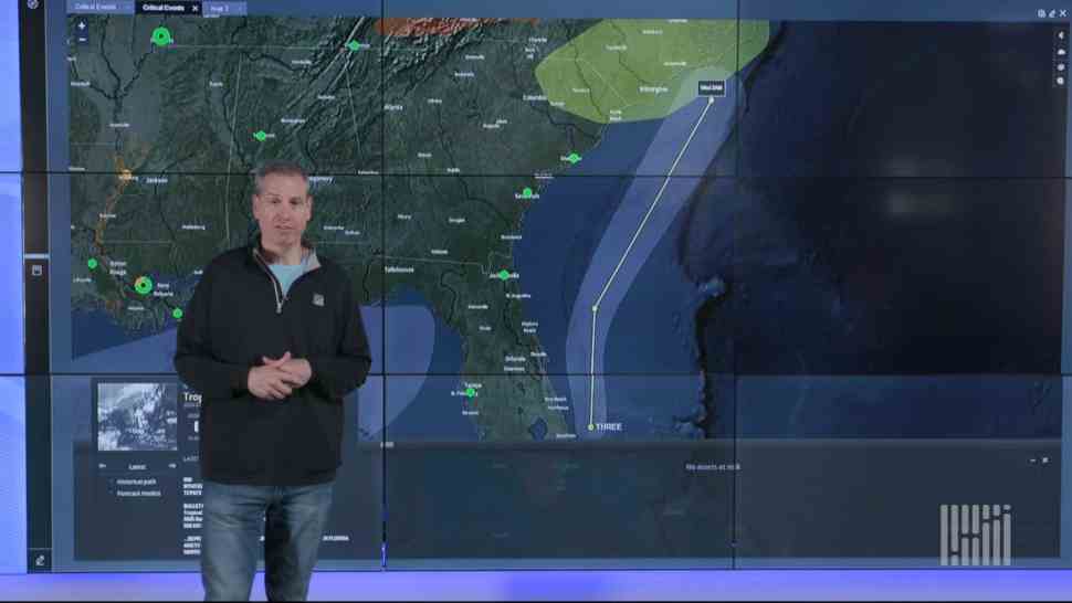
Rain continues to develop along a fairly slow-moving cold front heading across the Northeast and Southeast. Flash flooding remains a risk for some areas. Meanwhile, in the dry West, storms could add to the threat of wildfires.
South may get soaked

SONAR Critical Events: Severe thunderstorm and flash flood Watch areas for Tuesday, July 23, 2019.
The rain keeps falling today in the eastern and southern U.S., and the flash flooding risk in the Northeast should end by late-morning or early afternoon. The best odds for heavy downpours and localized flash flooding the rest of today will be from southeastern Virginia and the Outer Banks of North Carolina all the way to New Orleans. The National Weather Service (NWS) has not yet issued Flash Flood Watches for these areas, but drivers may run into roadblocks on portions of I-10, I-20, I-85 and I-95. Use this interactive map to check for official NWS alerts. Additionally, severe storms could produce large hail and intense wind gusts from southeastern Georgia to Virginia Beach.
Wildfire woes

SONAR Critical Events: Fire condition risk areas (shaded in yellow) for Tuesday, July 23, 2019.
Look for scattered thunderstorms this afternoon and evening across the Desert Southwest, the Great Basin and the northern Rockies. A few severe storms producing large hail and damaging winds could pop up along I-90 from Spokane to Butte, as well as on I-10 from Phoenix to Tucson. Also, many of these storms will be dry thunderstorms and may spark wildfires. If they spread quickly or close to highways, smoke could limit reduce visibility.
Tropical Alert

SONAR Critical Events: Tropical Depression Three (TD-3) forecast as of Tuesday morning, July 23, 2019.
Tropical Depression Three (TD-3) is spinning off the coast of southeastern Florida with maximum sustained winds of 35 mph (as of 5:00 a.m. Eastern time today, July 23). The storm may drop additional rainfall along the southeast coast of the U.S. over the next couple of days, as well as creating high surf and gusty winds. TD-3 may get just strong enough to become Tropical Storm Chantal, possibly making landfall in North Carolina’s Outer Banks on Wednesday, July 24.
Brokerage Compliance Symposium
The day before F3. Every compliance issue you face - fraud exposure, carrier liability, FMCSA rules, cargo theft, insurance gaps - navigated by attorneys and operators defining best practices in a changing industry.
F3 Awards Dinner
The night before F3. FreightTech100 companies honored. FreightTech 25 and Shipper of Choice winners revealed live. Cocktail reception into dinner and live music - 300 industry leaders in one purpose-built room.
F3: Future of Freight Festival
Industry-defining keynotes, rapid-fire technology demos, and industry leaders networking in experiences across Chattanooga - plus the inaugural F3 Awards Dinner featuring the FreightTech and Shipper of Choice reveals.
The day before F3. Every compliance issue you face - fraud exposure, carrier liability, FMCSA rules, cargo theft, insurance gaps - navigated by attorneys and operators defining best practices in a changing industry.
The Signal at Chattanooga Choo Choo • Chattanooga, TN Register NowThe night before F3. FreightTech100 companies honored. FreightTech 25 and Shipper of Choice winners revealed live. Cocktail reception into dinner and live music - 300 industry leaders in one purpose-built room.
The Signal at Chattanooga Choo Choo • Chattanooga, TN Register NowIndustry-defining keynotes, rapid-fire technology demos, and industry leaders networking in experiences across Chattanooga - plus the inaugural F3 Awards Dinner featuring the FreightTech and Shipper of Choice reveals.
The Signal at Chattanooga Choo Choo • Chattanooga, TN Register Now