




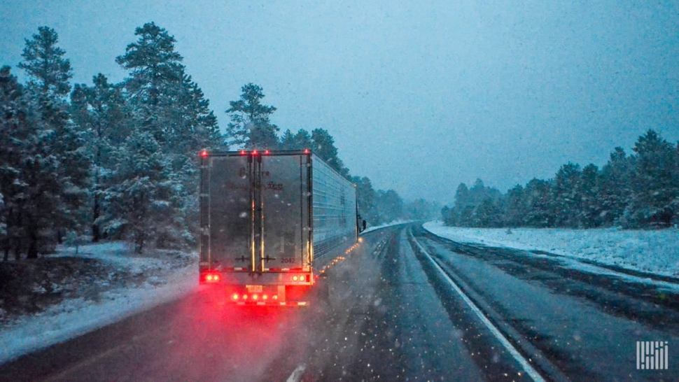
As featured on FreightWaves.com the past two days, the first notable snowstorm for the Mountain West is happening the rest of today, Nov. 20, lasting through tomorrow. It’s not unusual for a potent storm to hit this part of the U.S. this time of year, but shippers, carriers and drivers should still prepare for at least short-term disruptions in freight flows the rest of the week.
The set up

A low pressure system – the remnants of Tropical Storm Raymond – will spin over the region for the next two days. The storm is feeding off abundant moisture and energy flowing off the Pacific Ocean. The jet stream – the upper-atmospheric winds that steer weather systems across the world – should finally push the storm out of the western U.S. by early Friday, Nov. 22.
Snow amounts
Two-day snowfall totals could reach 12 to 24 inches in the southern mountains of Utah along and east of I-15. The Wasatch Plateau east of Salt Lake City could see up to 14 inches. In western Colorado and eastern Utah, places like Telluride, Crested Butte and the Abajo Mountains may get 10 to 20 inches, with isolated spots of nearly 30 inches. Many areas of Wyoming will see up to 12 inches of snow. Some mountains in New Mexico will receive more than 12 inches, with several inches spreading into Flagstaff, Arizona. Look for heavy snow in eastern California’s Sierra Nevada Range, as well as the mountains of southern Nevada. Strong winds and white-out conditions possible at times in some areas.
Since early this week, the National Weather Service (NWS) has been issuing various weather alerts across the region. Driving conditions will be dangerous, and potential roadblocks may last for hours where the snow and wind are especially harsh. Although the cities of Denver and Salt Lake City will be spared from heavy snowfall, air cargo may be delayed at their respective international airports. Disruptions are also possible at other regional assets such as railroads and oil/petroleum facilities, as indicated by the colored dots and “donuts” on the FreightWaves SONAR Critical Events map above.
The storm may put a brief damper on the up and coming Salt Lake City freight market, which covers most of Utah. Today’s FreightWaves SONAR data shows outbound volumes of reefer loads (ROTVI.SLC), as well as overall outbound volumes including reefers and dry vans (OTVI.SLC), have been rising over the past several days. This tells us there is a decent amount of reefer freight to pick up there. Reefers are climate-controlled trailers used to transport temperature-sensitive cargo.

However, some carriers may not want to send drivers into this market until the storm is gone and roads are in better condition. Carriers and dispatchers who do decide to send drivers there will need to make sure that, if the drivers are coming from a region of milder weather, they follow the proper “protect from freeze” guidelines or put their loads on reefers.
Flooding rains
The same storm dumping snow in the mountains will soak the lower elevations with periods of heavy rainfall and embedded thunderstorms. Flash flooding is likely at times from San Diego to Yuma, Phoenix, Tucson, and the valleys of southwestern Utah west of I-15. This will slow down drivers on portions of I-8, I-10, I-17 and I-40 due to reduced visibility and potential roadblocks. Parts of the region are in a serious drought and desperately need rain, but not this much at one time. Storm totals will be two to four inches with locally heavier amounts.
Short-term service interruptions are possible at the port of entry in Gallup, New Mexico, in addition to Phoenix Sky Harbor International Airport (ICAO code: PHX), Tucson International Airport (ICAO code: TUS) and San Diego International Airport (ICAO code: SAN).
Additional notes
Fire weather conditions have returned to northern California. Because of minor drought, high winds and extremely low afternoon relative humidity, wildfires could easily start. Risk areas include the Sacramento Valley and portions of the San Francisco metropolitan area.

Pacific Gas and Electric (NYSE: PCG) has issued public safety power shutoffs (PSPS) affecting around 150,000 customers in 18 counties. This is to ensure that power lines blown down by the winds don’t spark any fires. Affected areas are highlighted in purple in the Critical Events map directly above. The NWS is forecasting gusts up to 55 mph, possibly stronger in canyons and exposed ridges. Besides the fire danger, the winds will be rough on drivers and risky if their deadheading.
Tropical update
Typhoon Kalmaegi has weakened to a Tropical Storm since moving across the northern Philippines earlier today. Its winds are down to 45 mph as it begins to move into the South China Sea. In the same part of the world, Tropical Storm Fung-Wong, with sustained winds of 50 mph, will come close to Taiwan and the southern islands of Japan tomorrow and Friday, Nov. 21 and 22.
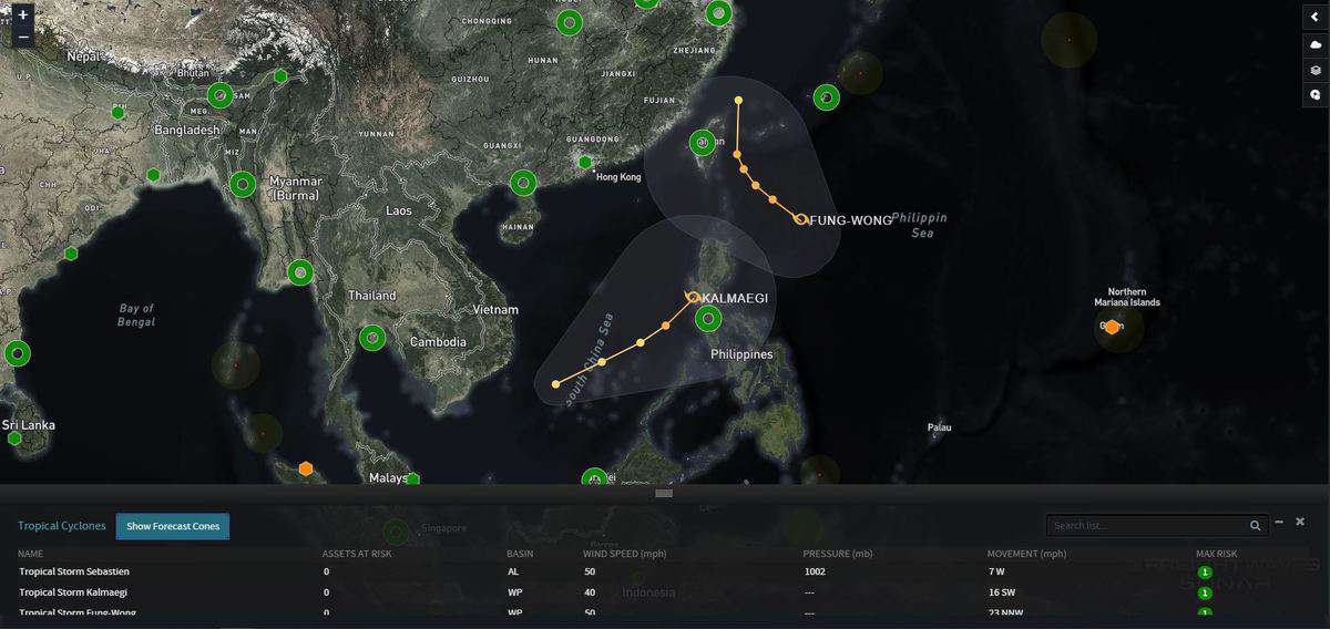
Tropical Storm Sebastien is spinning over the western Caribbean and will likely not be a threat to anyone on land. The National Hurricane Center (NHC) is forecasting Sebastien to move toward the northeast over the next few days, remaining over open waters.
Brokerage Compliance Symposium
The day before F3. Every compliance issue you face - fraud exposure, carrier liability, FMCSA rules, cargo theft, insurance gaps - navigated by attorneys and operators defining best practices in a changing industry.
F3 Awards Dinner
The night before F3. FreightTech100 companies honored. FreightTech 25 and Shipper of Choice winners revealed live. Cocktail reception into dinner and live music - 300 industry leaders in one purpose-built room.
F3: Future of Freight Festival
Industry-defining keynotes, rapid-fire technology demos, and industry leaders networking in experiences across Chattanooga - plus the inaugural F3 Awards Dinner featuring the FreightTech and Shipper of Choice reveals.
The day before F3. Every compliance issue you face - fraud exposure, carrier liability, FMCSA rules, cargo theft, insurance gaps - navigated by attorneys and operators defining best practices in a changing industry.
The Signal at Chattanooga Choo Choo • Chattanooga, TN Register NowThe night before F3. FreightTech100 companies honored. FreightTech 25 and Shipper of Choice winners revealed live. Cocktail reception into dinner and live music - 300 industry leaders in one purpose-built room.
The Signal at Chattanooga Choo Choo • Chattanooga, TN Register NowIndustry-defining keynotes, rapid-fire technology demos, and industry leaders networking in experiences across Chattanooga - plus the inaugural F3 Awards Dinner featuring the FreightTech and Shipper of Choice reveals.
The Signal at Chattanooga Choo Choo • Chattanooga, TN Register Now