


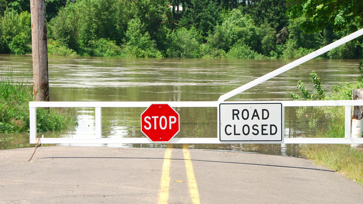
Heavy rain has caused flooding and road closures in the Upper Midwest, mainly along the Red River of the North and its tributaries.
Parts of eastern North Dakota and western Minnesota that were covered in snow received 2 to 4 inches of rain last Friday through Sunday, with the bulk of the rain hitting on Saturday. Waterways swelled quickly due to the intense rain and rapid snowmelt.
According to the National Weather Service, the Grand Forks International Airport in North Dakota had a three-day total of 2.46 inches, with 1.72 inches on Saturday. The Grand Forks NWS office was drenched with a three-day total of 3.38 inches, 70% of it on Saturday.
North Dakota and Minnesota transportation officials have reported state and U.S. highway closures in many places and additional closures will be possible over the next couple of days. The NWS is predicting rivers to keep rising. Warming temperatures and additional snowmelt will contribute to the issue.
Flood warnings remain posted along the Interstate 29 corridor from Fargo, North Dakota, to the U.S.-Canada border. This includes part of Interstate 94 where it intersects I-29 in Fargo.
More wet weather is likely later in the week from Friday into Saturday. Even if water levels recede before the next storm arrives, flooding could return along the Red River of the North and may hit other portions of the Upper Midwest and northern Plains.
Major lanes of concern
- Interstate 29 from Fargo to the North Dakota-Canada border.
- Interstate 94 from Valley City, North Dakota, to Detroit Lakes, Minnesota.
Click here for more FreightWaves articles by Nick Austin.
You might also like:
Trucker named Highway Angel for helping tornado victim
19 storms forecast to develop this hurricane season
Weather tales from the road: Trucker’s storm encounters no joke