


Since the remnants of Tropical Storm Beta exited the U.S. a few days ago, there’s been a pleasant lull in this year’s busy Atlantic hurricane season.

So many tropical storms and hurricanes have developed — 23 so far — that the list of assigned names was used up. This hadn’t happened since 2005. The National Hurricane Center (NHC) is now using Greek letters.
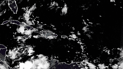
But a disturbance in the Caribbean could become the next tropical storm this weekend, soaking southern Florida with potentially flooding rainfall.
Setup and rainfall amounts
A tropical wave — a cluster of disorganized showers and thunderstorms — located over the central Caribbean Sea is forecast to move westward to northwestward over the next few days, interacting with a cold front moving from northern to southern Florida. This will produce a broad area of low pressure over the western Caribbean Sea by Thursday night or Friday as the front stalls over southern Florida.
Environmental conditions may be favorable for further development and organization, and a tropical depression or tropical storm could form over the weekend as the system moves slowly into the northwestern Caribbean Sea.
This weather pattern will send deep tropical moisture into southern Florida. Showers and some thunderstorms will develop, with periods of heavy rainfall. Totals could exceed 5 or 6 inches through this weekend in places like the Florida Keys, Miami, Fort Lauderdale and West Palm Beach. The grounds are still somewhat saturated from recent daily heavy thunderstorms, and any additional heavy rainfall could lead to flooding.
The NHC is pegging the odds at 60% that the disturbance in the Caribbean Sea will blossom into either a tropical depression or tropical storm between this weekend or early next week. If it becomes a tropical storm, it will be named Gamma.
Impact on freight
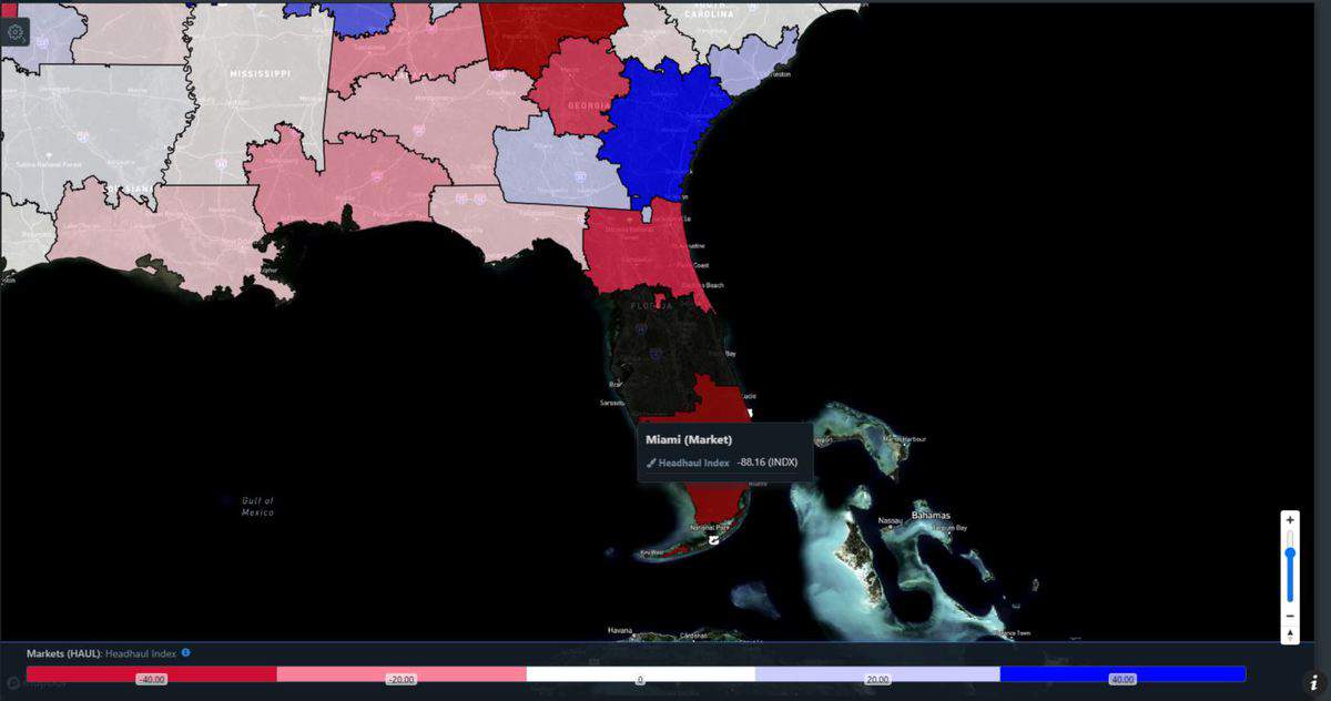
The areas of highest impact from potential flooding are in the Miami freight market, where many drivers may be dropping off loads over the next several days. This is evident based on the latest data from FreightWaves SONAR. Miami has the fifth-lowest Headhaul Index (HAUL.MIA) of the 135 U.S. markets. Headhaul measures the spread in a market’s outbound loads versus inbound loads.
Miami’s headhaul value of -88 indicates more freight is entering the market rather than leaving it. So there’s loose capacity — plenty of trucks — but drivers may have to deadhead somewhere else to find their next loads to pick up or they will have to wait for more outbound freight to become available in Miami.
Drivers heading to the Miami market with freight will hit minor delays due to the potential periods of heavy rainfall. They should be ready for at least minor delays from possible ramp and road closures along Interstates 75 and 95 as well as U.S. Highway 1.