Three tornadoes were reported to the National Weather Service (NWS) Wednesday, making it the third consecutive day this week that severe storms have slammed portions of the U.S.
Someone from the general public reported a brief tornado one mile north of Gulfport, Mississippi. It touched down along US-90 near Cowan Road.
About 25 minutes later, fire department staff reported a tornado several miles east of Escatawpa, Mississippi, near the Alabama border. This may be the same tornado that touched down near Gulfport.
The third tornado, reported by an emergency manager, hit West Baton Rouge Parish, Louisiana, about nine miles southeast of New Roads. The report was based on video evidence, as well as damage to trees and a cane field.
Severe winds of 60 to 70 mph damaged buildings, homes, trees and power lines in more than 100 locations Wednesday, the lowest total for any day this week.
Since Monday, the NWS has received around 400 reports of wind damage and large hail in more than a dozen states spanning the Plains, Southeast, Midwest and Northeast. For some regions, the threat for severe storms will rise Thursday and Friday as the atmosphere becomes more energized.
Plenty of warmth and humidity, along with a cold front, will make the air quite unstable. This will push thunderstorms to severe limits Thursday from Nebraska and the Dakotas, across Interstate 29 into Minnesota and Iowa.
The NWS classifies a thunderstorm as severe if it produces any of the following based on radar or eyewitness reports:
• Winds of at least 58 mph (50 knots).
• Hail at least 1 inch in diameter.
• A tornado.
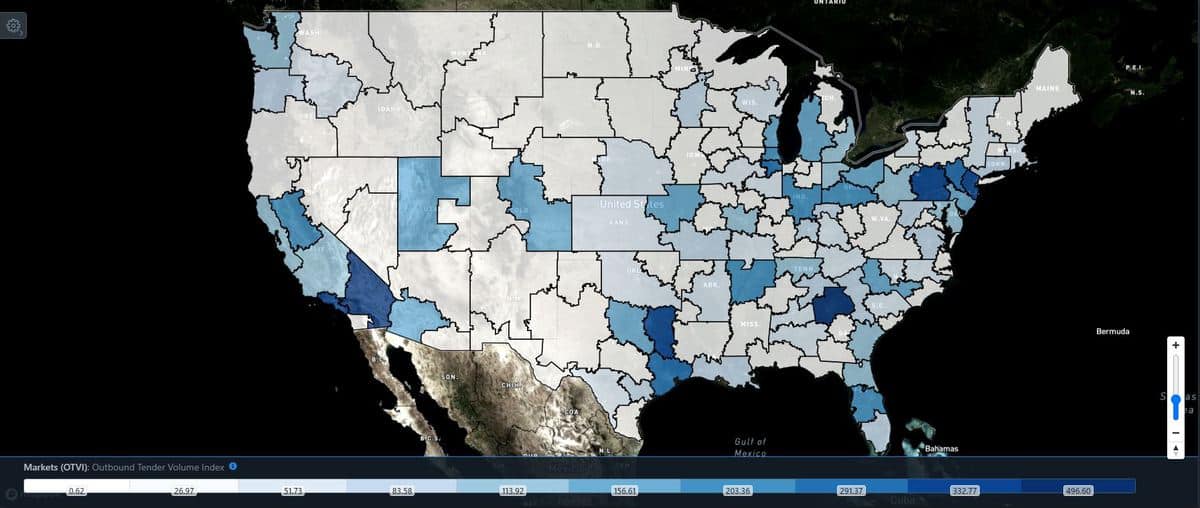
Friday, the risk shifts to the south and east, stretching from Kansas to Michigan, including the Des Moines, Chicago, Milwaukee, Green Bay and Detroit metropolitan areas. By Saturday, most severe storms will develop from eastern Ohio to the key freight markets of Allentown and Harrisburg, Pennsylvania, in addition to Elizabeth, New Jersey. These have some of the highest levels of outbound volumes in the nation.

The storms will be scattered throughout these regions, with all modes of severe weather possible – destructive winds, large hail and tornadoes (which will be isolated). Torrential rainfall at times could cause flash flooding and temporary roadblocks.
Click here for more FreightWaves articles by Nick Austin.


