


We hope all of you have had a happy and safe start to the new year! Unfortunately, the weather has been rough in some parts of the U.S. the past couple of days. Snow and wind and have caused problems in various regions, with one tractor-trailer rollover caught on video in Colorado. Mother Nature will continue to make this difficult for truckers this week, especially in the Northwest and Southeast.
First things first: Due to harsh winter weather, sections of I-80 remain closed in Wyoming. Look for updates here.
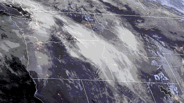
Roads will stay slick across portions of the Pacific Northwest and the Rockies. Look for a few more inches of additional snowfall today, Jan. 2, mainly through the morning hours in northern Idaho and western Montana. This includes the Bitterroot Range. A glaze of ice and gusty winds of 40 to 50 mph will make conditions that much more difficult for truckers on I-90 from Missoula to Bearmouth and from Lookout Pass to Ninemile; US-2 over Marias Pass and US-12 over Lolo Pass will also be trouble spots. Although snow has already been tapering in the Stevens Pass area on US-2, the highway will remain treacherous. Avalanches are possible in these areas due to the heavy snow and strong winds.

Tonight and tomorrow moderate to heavy snowfall returns to the high elevations of the Cascades, with drenching rain in some of the lower slopes and valleys, including the Seattle area. Watch out for strong winds gusting to 50 mph along the Pacific Coast and in Puget Sound. Additional periods of snow and rain will likely hit this region through the weekend and possibly into early next week, causing minor to moderate disruptions in freight movement on the I-5 corridor and other routes. The impact zone is highlighted in the FreightWaves SONAR Critical Events map above.
The nearly steady stream of moisture, called an atmospheric river, directed into the Pacific Northwest will produce total snowfall accumulations of 2 to 3 feet in the higher elevations of Washington, Oregon, Idaho and British Columbia, Canada. Some of the tallest peaks could get buried in 5 feet of snowfall. Strong winds will accompany the series of storms and add to the transportation disruptions on the roads, rails and runways, leading to occasional whiteout conditions. The interstate that looks most likely to be impacted by snow is I-90, especially near Snoqualmie Pass east of Seattle as well as across Idaho/western Montana. Check chain laws here for the latest updates on winter driving.
In the lower elevations within the impact zone, rainfall totals will be 2 to 4 inches, with localized areas of 6 to 8 inches. This includes areas from Vancouver to Seattle and Portland. The heavy rains may cause flooding and mudslides, particularly on and near westward-facing slopes in western Oregon, western Washington and British Columbia.
Air cargo could be delayed at times at Seattle-Tacoma International (ICAO code: SEA) and Portland International (ICAO code: PDX) airports. Operations at the ports of Seattle, Tacoma and Portland will be interrupted intermittently, as will several oil/petroleum facilities and railroads in the region. The storms may also make it difficult to load/unload freight at intermodal ramps. Based on the anticipated level of disruption, the assets at risk are color coded in SONAR Critical Events.
Impact on Freight
FreightWaves SONAR data shows that, in most freight markets in the Northwest region, capacity has become tighter than the rest of the country. This is indicated by the blue shading on the map below, showing the weighted rejection index (WRI). WRI is a combination of market share – a market’s outbound volume compared to the rest of the country – and weekly change in tender rejection rate – the percentage of electronically offered loads from shippers that have been turned down by carriers for any number of reasons.
With impending storms anticipated across the Pacific Northwest for the next several days, it may be difficult for drivers to get into the region to pick up loads from markets such as Seattle, Spokane, Pendleton, Portland, Missoula, Medford and Twin Falls. Nearby markets with possible available freight just outside the impact zone of the storms may be better bets. These would include Billings, Green River, Salt Lake City and Reno.

Other notable weather today, Jan. 2
A low-pressure system along the Gulf Coast will produce heavy rainfall, potential flash flooding and possible roadblocks from Louisiana to the southern Appalachians. Isolated tornadoes and severe crosswinds along I-20, I-55 and I-59 could pop up today and tonight from Baton Rouge and New Orleans to Meridian, Mississippi, and Tuscaloosa, Alabama. Scattered areas of heavy rainfall will linger, with some parts of the South receiving 3 to 5 inches over the two-day period.
Looking Ahead
Besides heavy snowfall, high winds will increase the risk of rollovers across northwestern and north-central Montana from tomorrow afternoon, Jan. 3, through the following afternoon. Southwesterly gusts will likely reach 65 to 80 mph in areas including, but not limited to, Logan Pass, Marias Pass, Heart Butte, Cut Bank, Great Falls, Kings Hill Pass, Helena, MacDonald Pass, Rogers Pass, Havre, Chinook and Lewistown.
High winds will also slam south-central Oregon and northern California tomorrow afternoon through tomorrow night. Winds will gust to 60 mph in California’s Shasta Valley, including I-5 between Weed and Yreka, as well as SR-299 over Cedar Pass; in Oregon, portions of SR-31 from Paisley to Summer Lake, several routes between Lakeview and Warner Mountain and most other mountain roads in Lake and far eastern Klamath counties; and eastern Modoc County, California.
Last but not least, winds will be howling again tomorrow through Sunday, Jan. 5, across southeastern Wyoming. Westerly gusts could exceed 65 mph, resulting in an elevated risk of blow-overs on I-80 over the summit between Cheyenne and Laramie, near Arlington, and between Cheyenne and Pine Bluffs; along I-25 from the Colorado border to Wheatland, north of Wheatland to Casper, and from Wheatland to Chugwater; and along US-85 between Cheyenne and Torrington.
The National Weather Service (NWS) has issued a high wind watch for these areas. These alerts are housed inside the Critical Events platform.
Here’s to a healthy and successful 2020! Have a great day, and be careful out there.
FreightWaves Market Expert Zach Strickland contributed to this article.
