


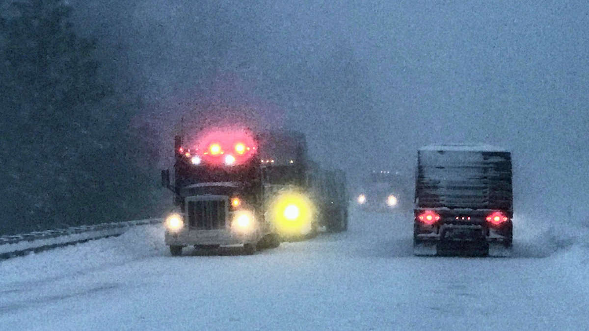
Truckers will hit another round of heavy snowfall and gusty winds Wednesday in the mountains of the Northwest. This has been a persistent pattern for more than a week, with some places seeing 3 to 5 feet of snow already in 2021.
This latest storm could dump another 6 to 12 inches in high elevations of the Washington and Oregon Cascades, the Blue Mountains in northeastern Oregon and the Rockies of northern Idaho. Look for moderate to locally major disruptions in supply chains and freight flows due to slick surfaces, periods of reduced visibility and potential road closures.
Included in the potential impact zone are U.S. Highway 2, I-84 and as I-90. Trouble spots include but are not limited to Snoqualmie, Lookout, Stevens, Marias and McKenzie passes.
The region will catch a break Thursday as the storm fades, but another storm will follow closely behind it. A cold front will produce another round of snowfall Friday, which could spread into portions of the Sierra Nevada, possibly affecting travel on Interstate 80 in eastern California.
Meanwhile, landslides have been reported in western Washington due to recent heavy rainfall. These could block routes along the Interstate 5 and U.S. Highway 101 corridors. More rain will soak these areas Wednesday and Friday.
Other areas of snowfall
A narrow band of snowfall will have minor impacts along the Interstate 29 corridor Wednesday, mainly from Fargo, North Dakota, to just north of Omaha, Nebraska. Only a few inches will accumulate.
Rain will change to snow in the Ozark Mountains Wednesday night, lasting through Thursday morning. Totals of 2 to 5 inches will be common from southern Missouri to northern Arkansas, but the highest elevations in northwestern Arkansas could see up to 6 inches. Expect messy conditions on Interstate 44 through the Springfield, Missouri, area.
