


Severe thunderstorms slammed portions of the Northeast in the wee hours today, with dozens of wind damage reports from Ohio to West Virginia, Pennsylvania, Maryland and New York.

The cold front responsible for producing these storms has lost some steam, but it will linger across the Eastern Seaboard today and Friday.
Additional showers and thunderstorms could hit some areas with torrential downpours, from New England to the Carolinas. The National Weather Service (NWS) has issued a flash flood watch for a large portion of North Carolina, including the Raleigh-Durham area. However, localized flash flooding is possible in the Northeast, too.
Another cold front will move through the eastern United States Friday, triggering more showers and storms in many areas that will get drenched today.
A few of today’s storms could contain isolated severe wind gusts of 60 mph, especially in the Northeast, but tornadoes and large hail are unlikely.
Minor delays in freight flows, as well as ground and air transportation, are possible over the next two days on the Interstate 85 and 95 corridors.
Other notable weather
Extremely windy conditions and an increasing chance of rollovers will develop Friday across Nevada, along a 320-mile stretch from the Reno-Carson City metropolitan area to the northeast corner of the state.
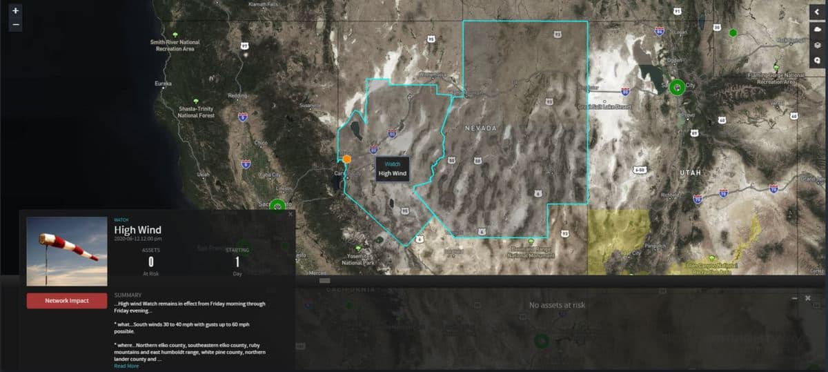
Gusty crosswinds from the south will reach 60 to 70 mph along parts of I-80, with sustained winds of 30 to 40 mph. Deadheading or hauling light loads will be risky.
Tropical update
A low pressure system over the Philippines is becoming better organized and could become a typhoon this weekend.
Since FreightWaves first published an article about this yesterday, the system has strengthened into Tropical Depression Butchoy (local name in the Philippines), with sustained winds around 28 mph and gusts to 35.

According to the Philippine Atmospheric, Geophysical, and Astronomical Services Administration, the depression will intensify enough to become a typhoon with the international name Nuri which could hit the Port of Hong Kong Sunday, June 14.
Click here for more FreightWaves articles by Nick Austin.
