


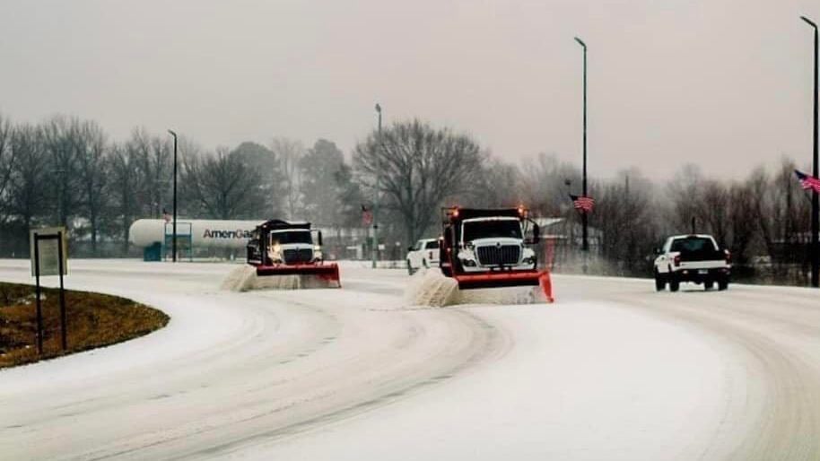
A winter storm that began Wednesday has been spreading sleet and freezing rain from Texas to the mid-South and Ohio Valley. These regions remain at risk for additional accumulations Thursday.
The combination of ice and heaping sleet led to accidents, road closures and power outages in Arkansas. More than 31,000 customers, mostly to the northeast of Little Rock, still had no electricity as of early Thursday morning.
The National Weather Service is continuing winter storm warnings Thursday from Dallas to just south of Oklahoma City, as well as Little Rock, St. Louis, northwestern Tennessee, southern Illinois and far western Kentucky. These are areas that are most likely to see more sleet and freezing rain, with total ice accumulations of one-quarter to one-half inch from Arkansas northward.
The storm will head into the Northeast Thursday night and Friday, gaining a bit of steam. Heavy snow will pile up across the interior Northeast, with up to 12 inches piling up in parts of upstate New York and New England. Light freezing rain is possible as well, and the NWS has winter storm warnings posted for these areas.
Related: Tips for truckers: How to weather a snow squall
A more serious ice storm warning has been issued for portions of central Pennsylvania to northern West Virginia and western Maryland, where ice accumulation could reach close to one-half inch.
The Interstate 95 corridor from Philadelphia to south of Boston will mainly see rain with periods of light to moderate mixed precipitation.
Expect at least intermittent disruption to business operations, freight flows and supply chains. Additionally, the storm could slow down loading and unloading of freight at intermodal ramps and air cargo may be delayed. Additional traffic jams and road closures are likely, as well as scattered to widespread power outages are possible due to the weight of snow and ice.
Major lanes of concern
• Interstate 35 from Dallas to Oklahoma City.
• Interstate 40 from Oklahoma City to Little Rock.
• Interstate 44 from Wichita Falls, Texas, to St. Louis.
• Interstate 64 from St. Louis to Louisville, Kentucky.
• Interstate 65 from Indianapolis to Nashville, Tennessee.
• Interstate 70 from St. Louis to Frederick, Maryland.
• Interstate 80 from Toledo, Ohio, to Teaneck, New Jersey.
• Interstate 95 from Philadelphia to the Maine-Canada border.
Click here for more FreightWaves articles by Nick Austin.
You might also like:
Where are truckers most at risk from February tornadoes?
Truckers honored as Highway Angels for feeding snowbound drivers

YourNew SecretWeapon
“I love the YourNewSecretWeapon.com and I resell it to all my clients, in addition to using the platform for myself to generate clients. I own a Digital Marketing Agency, and I am giving a big thumbs up and recommend it to any business owner.” -Brian, Marketing Agency (Website: http://www.YourNewSecretWeapon.com )