


Truckers will have to chain up the next few days as heavy snowfall spread across several Western states. High winds will make driving even more dangerous in some areas.
Outlook
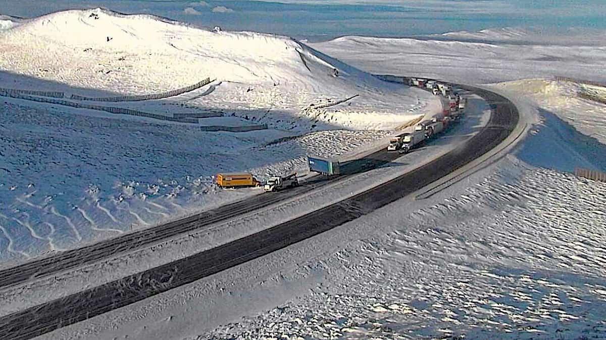
A strong cold front, plus abundant moisture flow from the Pacific, will track through the Washington and Oregon Cascades, the Wasatch Range in Utah, as well as the Rockies of Idaho, Montana, Wyoming and Colorado. Look for 12 to 24 inches of snowfall in many areas from Friday through the weekend. Going over mountain passes will be particularly dangerous.
In some spots, wind gusts will reach 50 to 80 mph. Blowing snow will lead to occasional whiteout conditions and potential road closures along portions of Interstates 15, 70, 80, 84 and 90. Power outages are likely, too, as winds blow down trees and utility lines.
High winds will also make driving risky in areas that will see less snowfall, like southeastern Wyoming, eastern Colorado and northeastern New Mexico. This includes Interstates 25 and 80 in places such as Cheyenne and Laramie, Wyoming; Denver, Fort Collins and Colorado Springs, Colorado; and Taos and Santa Fe, New Mexico. Deadheading — hauling empty trailers — would be a bad idea.
The widespread snowfall should change to rainfall early next week as temperatures warm.
While snowfall slams the mountains, rain and damaging winds will hit lower elevations along parts of Interstate 5 from Seattle to Portland, Oregon, as well as U.S. Highway 101.
Impact on freight

Parts of the Pendleton, Oregon; Twin Falls; Idaho; and Salt Lake City, Utah markets are in the path of this snowstorm. FreightWaves SONAR shows these markets each have a high Reefer Outbound Tender Volume Index (ROTVI). This means a lot of shippers are offering loads of temperature-controlled freight for carriers to pick up there. However, the storm will delay truckers arriving there Friday if they can’t leave before the storm intensifies later in the day. Otherwise, they will have to wait until next week.
Winter experience
Driving straight when the road Is slanted into the ditch when the road is like an icycle you’ll drive straight while the truck is being sucked sideways into the ditch. That happened to me just south of Chicago going towards Indianapolis between a pilot/ Wendy’s / flying J and a TA/ Love’s. I had to stay in the hammer lane to keep from sliding sideways while driving straight