




Updated Wednesday, Dec. 16, 2020 at 3:15 p.m. EDT
A strong nor’easter is only hours away from impacting northeastern supply chain networks on the ground and in the air. This includes most major metropolitan areas along the Interstate 95 corridor, where COVID-19 vaccine shipments may be headed.
Impact on freight
United (NYSE: UAL) and Delta (NYSE: DAL) airlines have announced restrictions on specialized cargoes at the following international airports: Boston Logan (ICAO code: BOS), LaGuardia (ICAO code: LGA), John F. Kennedy (ICAO code: JFK), Newark Liberty (ICAO code: EWR), Philadelphia (ICAO code: PHL), Baltimore/Washington (ICAO code: BWI), Bradley (ICAO code: BDL) and Washington Dulles (ICAO code: IAD). Other carriers may follow suit.
Regarding restrictions of ship-to-shore operations and/or vessel movement at Northeast ports, the Coast Guard told FreightWaves Tuesday that “there are no restrictions at the moment. If that changes, we’ll be sure to put out notifications.”
Jonathan Hunter, weather department manager at Covenant Logistics Group, told FreightWaves “With tight freight capacity already, Covenant has limited availability to head to the Northeast ahead of the Nor’easter. We are expecting delays to parts of the Mid-Atlantic through Thursday afternoon due to the snow and additional state imposed Commercial Vehicle restrictions.”
This storm will affect tens of millions of people and some of the most important supply chain hubs in the nation. Besides I-95, other major interstates within the risk zone that will experience delays include I-90, I-80, I-70, I-64, I-81, I-77, I-76, I-79, I-87, I-91, I-86, I-84, I-89 and I-93. Norfolk Southern (NYSE: NSC) and CSX (NYSE: CSX) are the primary rail carriers within the potential impact zone.
Latest forecast
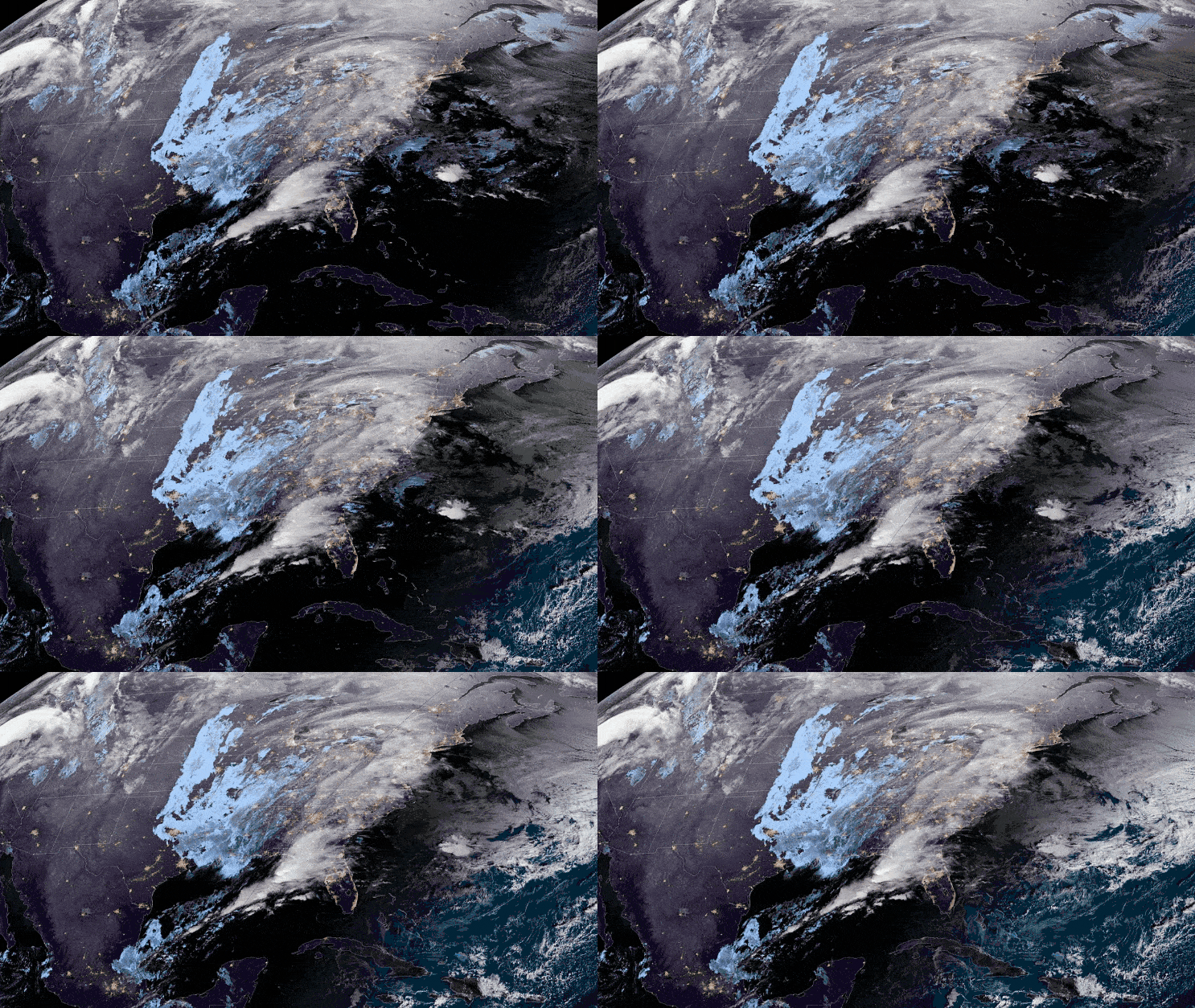
The forecast hasn’t changed much since Tuesday. The most recent computer models indicate that a band of heavy snow will fall across a large section of the Northeast from around midday Wednesday through Thursday. Look for widespread accumulations of 6 to 12 inches along I-95, north of Baltimore and Washington. Some locations west of I-95 may get 15 to 24 inches.
Very strong winds will develop over the area, causing widespread blowing snow and periods of whiteout conditions. Gusty winds will also lead to coastal flooding and erosion, high surf and issues in ports. Due to the combination of snowfall and winds, road closures and scattered power outages will be inevitable in many areas.
(Image: NOAA)

Washington and Baltimore will probably see the least amount of snow — maybe a few inches. Rather, these two cities will experience a wintry mix of rain, sleet, freezing rain and snow. Icy roads and runways could be an issue, in particular, in portions of eastern West Virginia, the western half of Virginia and northern North Carolina.
Although the storm will be a quick mover, some of its impacts will linger after the storm exits the region late Thursday.
Brokerage Compliance Symposium
The day before F3. Every compliance issue you face - fraud exposure, carrier liability, FMCSA rules, cargo theft, insurance gaps - navigated by attorneys and operators defining best practices in a changing industry.
F3 Awards Dinner
The night before F3. FreightTech100 companies honored. FreightTech 25 and Shipper of Choice winners revealed live. Cocktail reception into dinner and live music - 300 industry leaders in one purpose-built room.
F3: Future of Freight Festival
Industry-defining keynotes, rapid-fire technology demos, and industry leaders networking in experiences across Chattanooga - plus the inaugural F3 Awards Dinner featuring the FreightTech and Shipper of Choice reveals.
The day before F3. Every compliance issue you face - fraud exposure, carrier liability, FMCSA rules, cargo theft, insurance gaps - navigated by attorneys and operators defining best practices in a changing industry.
The Signal at Chattanooga Choo Choo • Chattanooga, TN Register NowThe night before F3. FreightTech100 companies honored. FreightTech 25 and Shipper of Choice winners revealed live. Cocktail reception into dinner and live music - 300 industry leaders in one purpose-built room.
The Signal at Chattanooga Choo Choo • Chattanooga, TN Register NowIndustry-defining keynotes, rapid-fire technology demos, and industry leaders networking in experiences across Chattanooga - plus the inaugural F3 Awards Dinner featuring the FreightTech and Shipper of Choice reveals.
The Signal at Chattanooga Choo Choo • Chattanooga, TN Register Now