




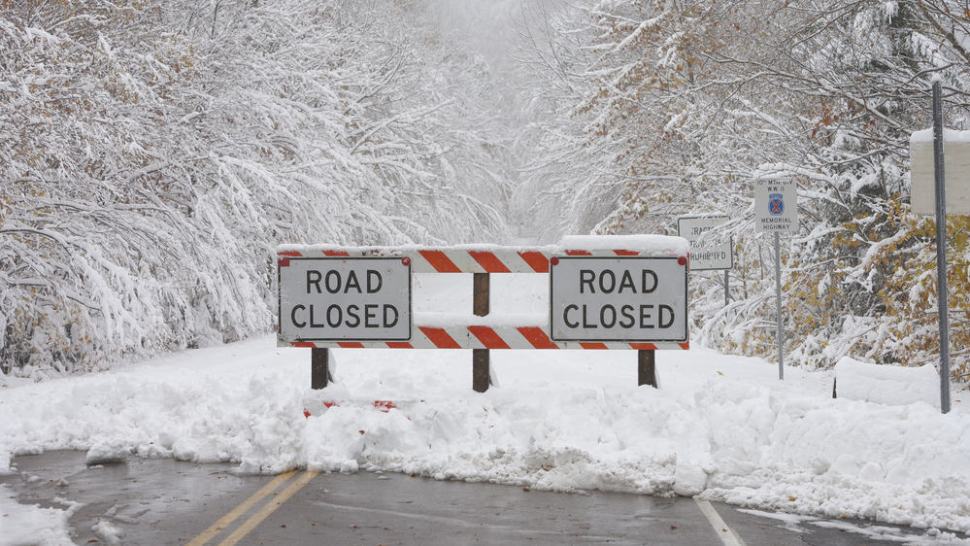
Like the movie “Groundhog Day,” a virtual repeat of lake-effect snowfall will hit parts of the Northeast today, Nov. 15. It’s been happening all week, so give Mother Nature credit for consistency. Meanwhile, soggy weather will punctuate the end of a relatively quiet weather week in the South.
Additional snow squalls are possible this afternoon as an arctic front moves across northern portions of New York state, Vermont, New Hampshire and Maine. This will be followed by possible lake-effect snowfall as cold, northwesterly winds blow across the relatively warmer waters of Lake Ontario, Lake Champlain and the St. Lawrence River. Areas in the target zone include, but are not limited to Potsdam, Saranac Lake, Plattsburgh, Burlington, Montpelier, Berlin, Presque Isle and Caribou.
Freight markets that include these areas aren’t known for high outbound volumes, but drivers may run into problems making local and regional deliveries on sections of the I-87, I-89, I-91 and I-93 corridors. Parts of several U.S. routes could be treacherous, too.
The front will produce quick, heavy snow burts totaling up to one inch (on top of what may still be on the ground), along with gusty winds as high as 35 mph. White-out conditions are possible due to blowing/drifting snow. Behind the front, temperatures will plummet to sub-zero readings in some spots to only single digits above zero in other locations, resulting in a potential flash freeze and icing of untreated roads and other surfaces.
The forecast looks promising for everyone who is tired of the lake-effect cycle as snowfall chances should be slim to none this weekend.

Look for wet weather along the I-95 corridor (and other highways) from northeastern Florida to North Carolina. Heavy rain may cause flash flooding in some spots, especially in the Outer Banks of North Carolina, where rainfall totals could be around two inches. In addition to showers, thunderstorms could pop across the Florida peninsula and the Outer Banks where a frontal boundary has stalled. Minor tidal flooding is possible today in coastal communities from Charleston, South Carolina to Flagler Beach, Florida.
A low pressure cell developing along the previously mentioned stationary front will spin off the Southeastern coast of the U.S. this weekend, possibly producing an additional two inches of rainfall in the Outer Banks. Wind gusts of 55 to 65 mph on Saturday and Sunday, Nov. 16 and 17, will lead to potential coastal flooding, beach erosion, power outages and roadblocks. Some areas may get hit with two to four feet of inundation above ground level. Coastal flooding could also strike areas of Virginia along Chesapeake Bay.

Other notable U.S. weather
Scattered rain and snow showers will move through the Cascades of Washington and Oregon today, in addition to the northern Rockies of Idaho and Montana. This should cause only minor travel issues. A mess of rain, freezing rain and snow could develop from Hannibal, Missouri to Chicago, Madison and Milwaukee on Saturday night and Sunday, Nov. 16 and 17.
Health could be an ongoing concern for some drivers in the Pacific Northwest. Bad air quality may persist through Tuesday, Nov. 19, in portions of southern Oregon, including Medford, Ashland and Klamath Falls. An extended period of high pressure and light winds has produced a stagnant air mass over the region, with pollutants trapped in the lower atmosphere. Drivers with heart or respiratory conditions should spend as little time as possible outside of their trucks.
Tropical update

Tropical Depression Kalmaegi is still spinning over the western Phillipine Sea, moving toward the Philippines. It is producing sustained winds of only 35 mph, maintaining virtually the same strength for the past 48 hours. However, Kalmaegi will likely intensify this weekend. It probably won’t reach typhoon strength – winds of at least 74 mph – but winds could be at 50 to 60 mph upon landfall.
On Kalmaegi’s updated forecast track, winds and storm surge will increase in the far northern Philippines this weekend, with a direct landfall possible around Monday morning local time, Nov. 18. Shippers may have to deal with short-term delays in ocean freight. Minor disruptions are likely to local and regional business and supply chain operations.

Tropical Storm Raymond became a named storm earlier today, generating sustained winds of 45 mph. Raymond could get stronger over the next 24 to 36 hours, but won’t likely reach hurricane status (winds of at least 74 mph). The storm’s winds will then probably weaken just prior to landfall in Baja California early Monday, Nov. 18. However, Raymond may still produce heavy rainfall – two to four inches – and flash flooding in southern portions of Baja California.
Brokerage Compliance Symposium
The day before F3. Every compliance issue you face - fraud exposure, carrier liability, FMCSA rules, cargo theft, insurance gaps - navigated by attorneys and operators defining best practices in a changing industry.
F3 Awards Dinner
The night before F3. FreightTech100 companies honored. FreightTech 25 and Shipper of Choice winners revealed live. Cocktail reception into dinner and live music - 300 industry leaders in one purpose-built room.
F3: Future of Freight Festival
Industry-defining keynotes, rapid-fire technology demos, and industry leaders networking in experiences across Chattanooga - plus the inaugural F3 Awards Dinner featuring the FreightTech and Shipper of Choice reveals.
The day before F3. Every compliance issue you face - fraud exposure, carrier liability, FMCSA rules, cargo theft, insurance gaps - navigated by attorneys and operators defining best practices in a changing industry.
The Signal at Chattanooga Choo Choo • Chattanooga, TN Register NowThe night before F3. FreightTech100 companies honored. FreightTech 25 and Shipper of Choice winners revealed live. Cocktail reception into dinner and live music - 300 industry leaders in one purpose-built room.
The Signal at Chattanooga Choo Choo • Chattanooga, TN Register NowIndustry-defining keynotes, rapid-fire technology demos, and industry leaders networking in experiences across Chattanooga - plus the inaugural F3 Awards Dinner featuring the FreightTech and Shipper of Choice reveals.
The Signal at Chattanooga Choo Choo • Chattanooga, TN Register Now