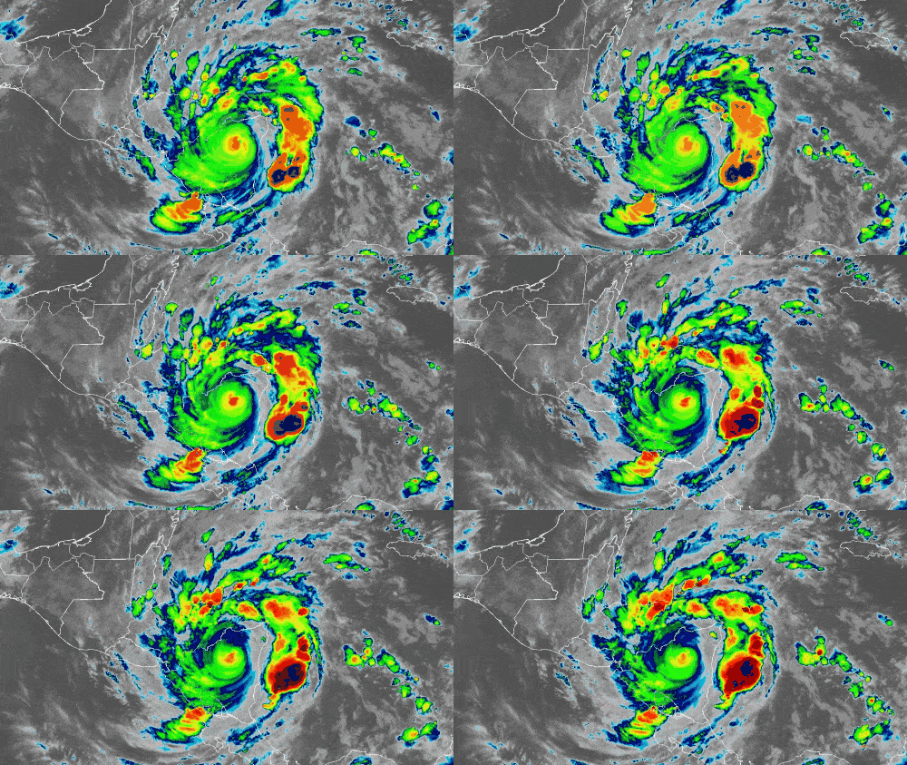
Iota has become the second major hurricane to hit Central America in the past two weeks, packing winds of 155 mph at landfall. It’s the strongest November hurricane on record to hit Nicaragua. It’s also the strongest hurricane of the 2020 Atlantic season, and the strongest on record this late in any given season.
The eye of the hurricane hit the northeastern coast of Nicaragua late Monday evening, just 15 miles south of where major Hurricane Eta made landfall on Nov. 3. Eta’s winds were 140 mph.
As of 7 a.m. EST Tuesday, Iota’s winds have dramatically weakened to 85 mph as it moves westward across rugged, mountainous terrain. However, heavy rainfall will produce potentially catastrophic flooding over the next two days.
Rainfall forecast
Iota is expected to produce the following rainfall amounts through Thursday:
• Honduras, northern Nicaragua, southeastern and central Guatemala and southern Belize: 10 to 20 inches, with isolated totals of 30 inches.
• El Salvador and Panama: 4 to 8 inches, with isolated totals of 12 inches.
This rainfall will lead to significant, life-threatening flash flooding and river flooding, along with mudslides in areas of higher terrain.
Parts of southern Nicaragua and Costa Rica could see 3 to 5 inches of rainfall, with isolated totals of 10 inches.
Storm surge forecast
While flooding is the primary threat, a life-threatening storm surge will raise water levels by as much as 5 to 10 feet above normal tide levels along the coasts of Nicaragua and Honduras. Near the coast, the surge will be accompanied by large and destructive waves.
Wind forecast
Winds will continue to weaken Tuesday, but some power and communication outages are possible as Iota tracks farther inland. By the afternoon, winds should be down to tropical storm force.
Impacts on freight
Iota and Eta did not strike near any major global seaports. However, severe damage to local and regional infrastructure and supply chains is likely. Roads and bridges may be washed out by flooding, as well as utility and communication lines blown down by the winds. Widespread crop damage is also likely. It could conceivably take years for damaged areas to fully recover from these back-to-back major hurricanes.


hadhira afrin
terrific one